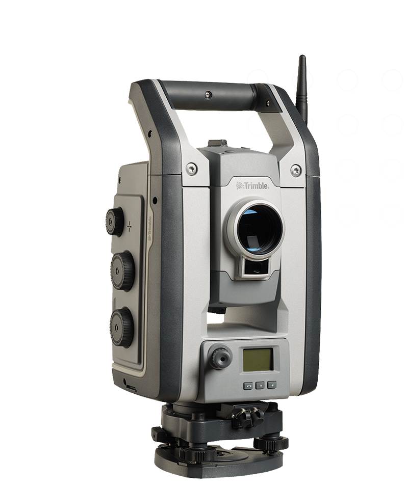
Built on proven Trimble technologies, including Trimble® MagDrive™, SurePoint™, and the DR Plus EDM, the Trimble S5 robotic total station is efficient and dependable while maintaining high accuracy.
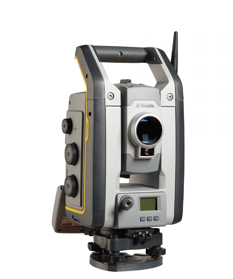
As a feature-rich robotic total station with an included radio, Trimble® S7 total station enables single-user operation. It's the only instrument you need on the jobsite, maximizing your efficiency every day.
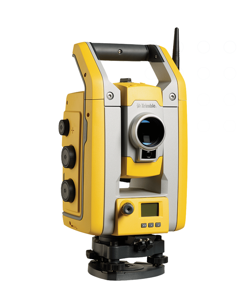
The Trimble® S9 total station is a high-performance robotic total station capable of tackling demanding monitoring, rail, mining and tunneling applications with optimal speed, accuracy and reliability.
Trimble® C5 mechanical total stations are used by survey pros for faster, simpler surveying. Get more accurate measurements quickly and easily carry into any terrain with this rugged, productivity-boosting total station.
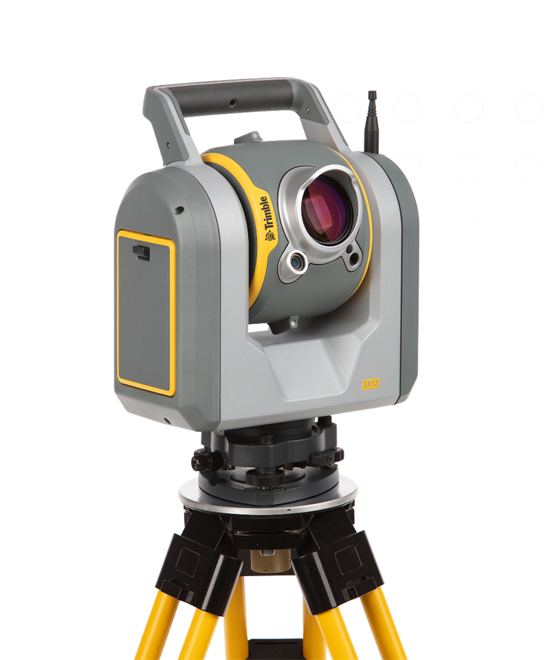
By combining innovative technology with intuitive functionality the Trimble® SX12 scanning total station saves time and maximizes efficiency.
Powered by the Trimble® Catalyst™ GNSS positioning service, the DA2 receiver, combined with a Catalyst service subscription, delivers centimeter to sub-meter accuracy to location-enabled Android and iOS field apps and workflows.
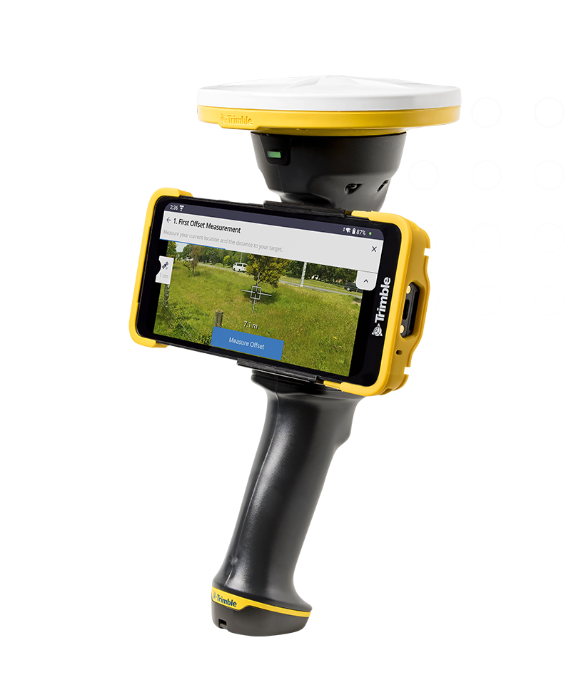
The Trimble® HPS2 handle combines the Trimble DA2 GNSS receiver with an EDM (electronic distance measurement). Compatible with data collection and visualization apps, it leverages modern smartphone cameras and sensors to be a lightweight and flexible field tool.
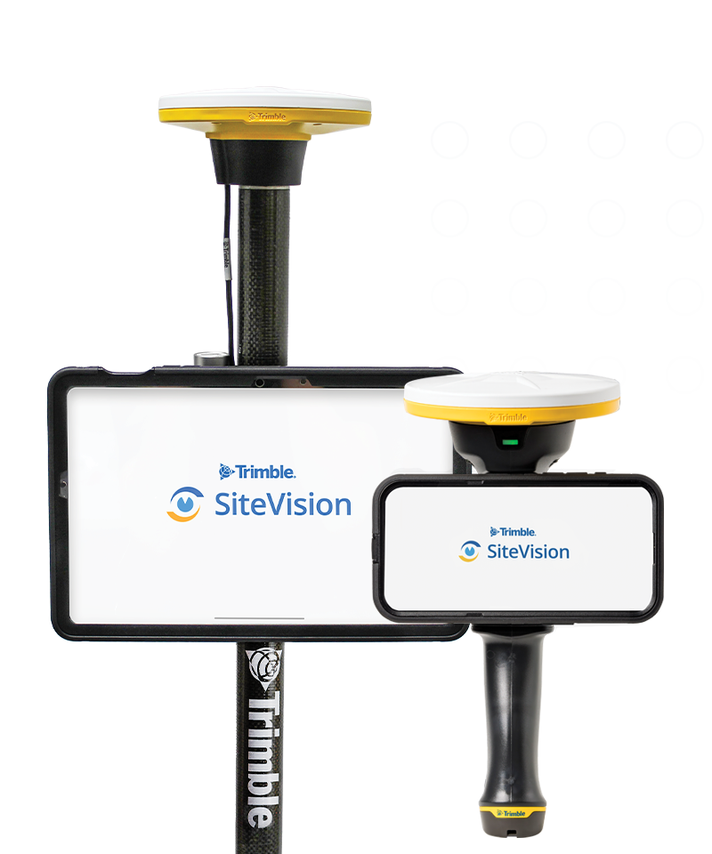
Trimble® SiteVision® is a real-time, in-field visualization software for collaborating on project progress and detecting design changes or conflicts. Choose your hardware configuration to collect images, GNSS points, EDM points or LiDAR scans.
The Trimble® TDC6 data collector is a powerful, versatile and cost-effective field data collection solution for surveying and mapping professionals. Use the TDC6 standalone as a GIS data collector, paired with a GNSS receiver or as an onboard total station controller.
The Trimble® TSC7 controller combines the best of a tablet, laptop and rugged field controller. This versatile and powerful device delivers the latest in field technology to connect you directly to streamlined survey workflows.
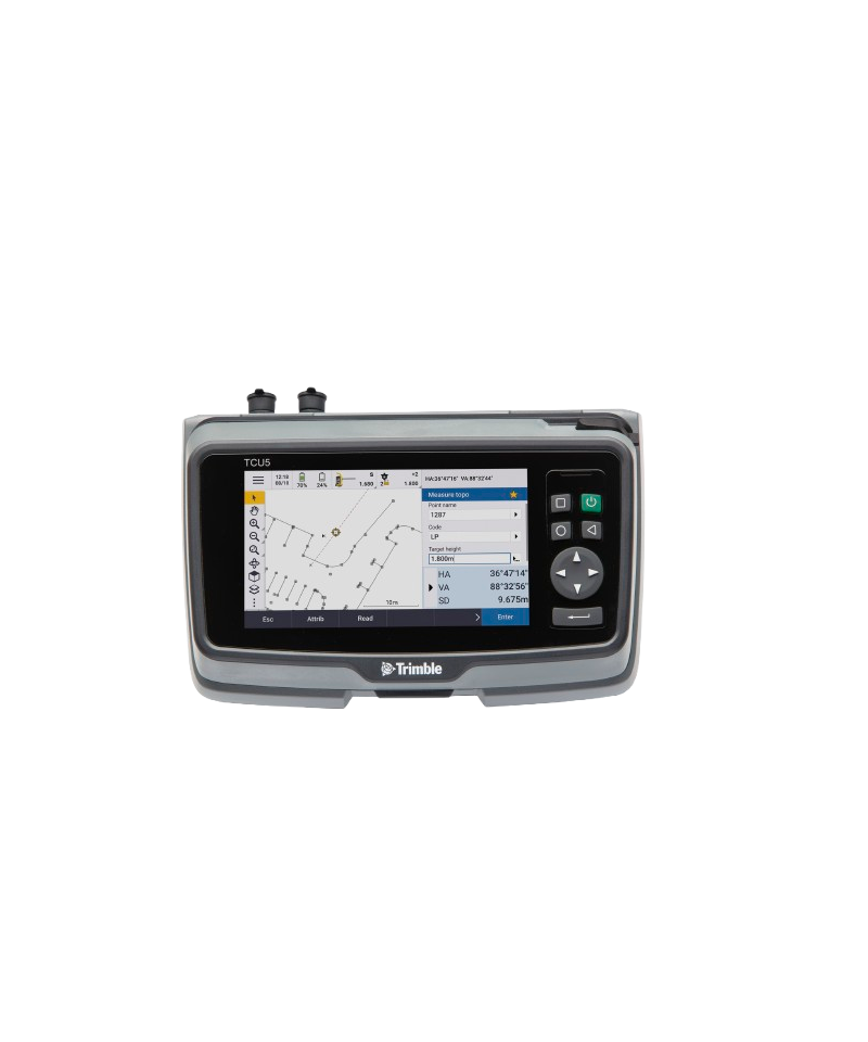
The advanced Trimble® TCU5 data controller enhances the productivity of your Trimble S-series total station. With a rugged and durable construction, the TCU5 can withstand even the harshest working conditions.
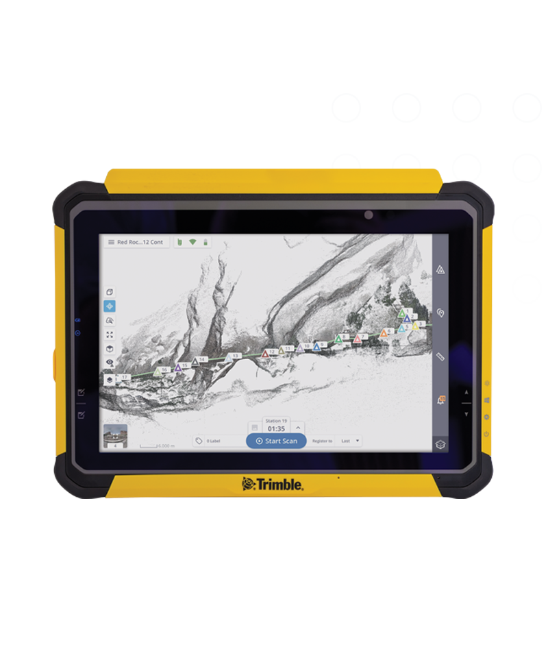
Boost your productivity in reality capture, survey and construction workflows with the high-performance Trimble® T110 tablet. Enjoy unmatched speed, seamless data flow and reliable, uninterrupted operation.
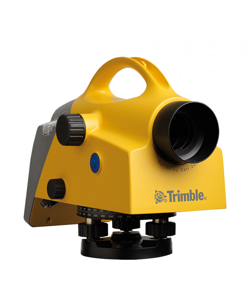
The Trimble® DiNi® level helps you be more productive by measuring heights significantly faster than with conventional automatic leveling, even in low lights. Eliminate errors and reduce rework with this digital height measurement sensor.
The Trimble® GNSS Ti-V2 Choke Ring geodetic antenna design is proven around the world to be effective in reducing the strength of most multipath signals. This advanced antenna has taken the choke ring design to the next level, with exclusive electronics, improved low noise amplification and GNSS tracking.
The Trimble® Zephyr™ 3 Geodetic antenna utilizes the Trimble Stealth ground plane to function optimally in areas with high multi-path interference. It is protected by weather-resistant materials and a low profile design.
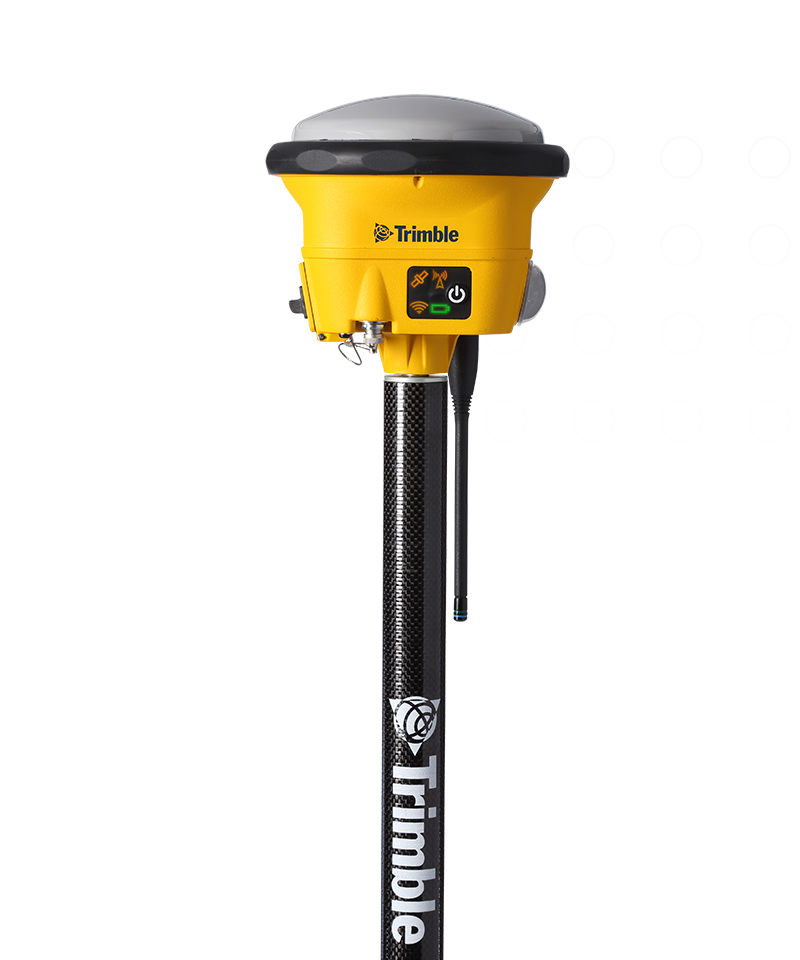
Depend on the Trimble® R580 GNSS system to keep you working with survey precision. Powered by the industry-leading Trimble ProPoint® GNSS engine, this everyday integrated receiver delivers greater productivity and reliable accuracy in more places.
The Trimble® R780 GNSS receiver allows you to choose your configuration and scale up by adding additional features. With robust GNSS positioning technologies, trust this ultra-durable receiver to boost your productivity and flexibility in any environment.
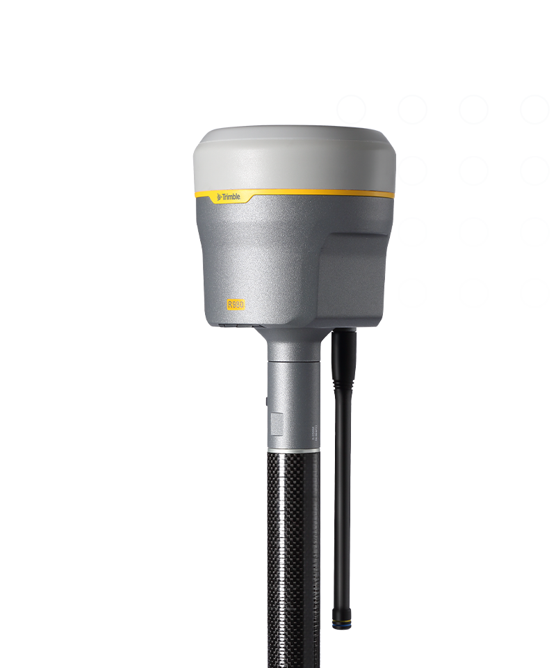
The Trimble® R980 GNSS system unlocks peak accuracy and productivity for land surveyors with proven GNSS performance. Overcoming challenging GNSS conditions and excelling in remote locations, the R980 is ready to work wherever the job leads you.
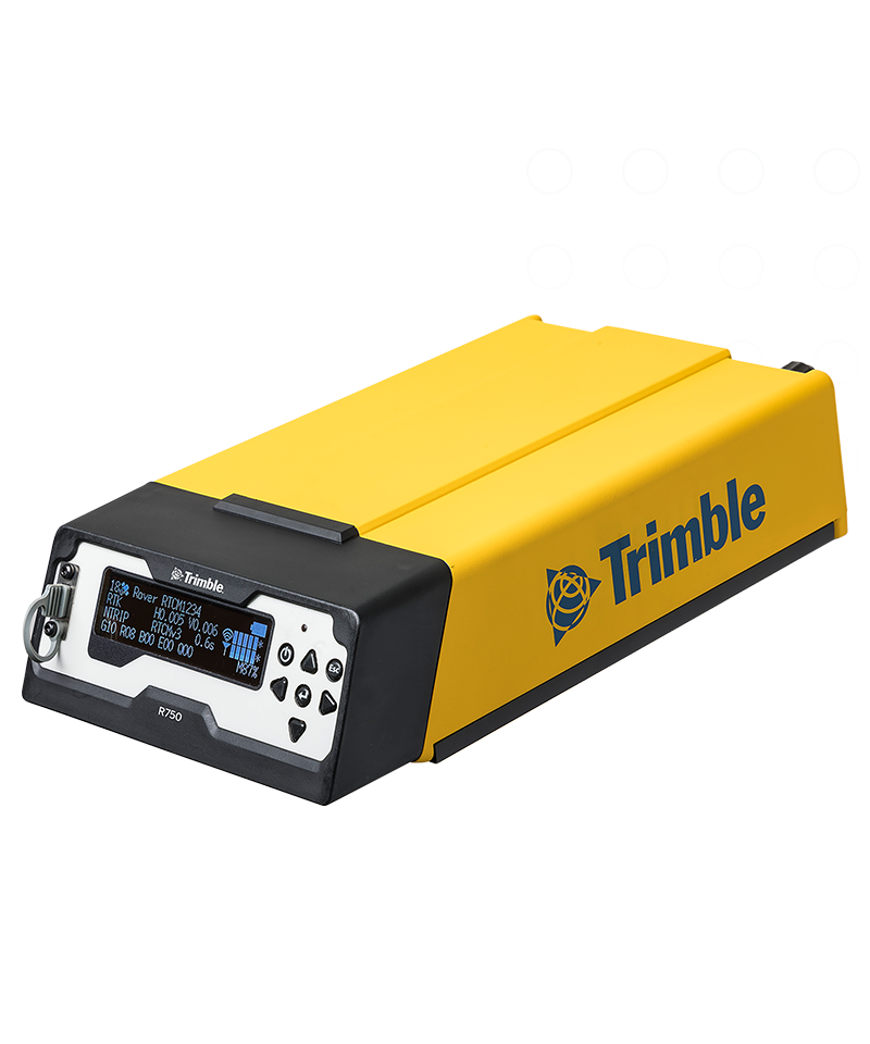
Get reliable coverage wherever you work with the Trimble® R750 Model 2 modular GNSS receiver. This easy-to-use base station solution works efficiently and accurately, even in tough conditions, providing all the information you need at your fingertips.
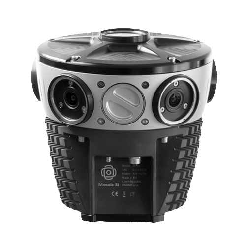
High Precision 360° Camera for Panoramic Street View, Photogrammetry, 3D Scanning and Industrial Applications
Beyond Limits: 75MP AI-Compatible 360° Camera for Industrial Applications
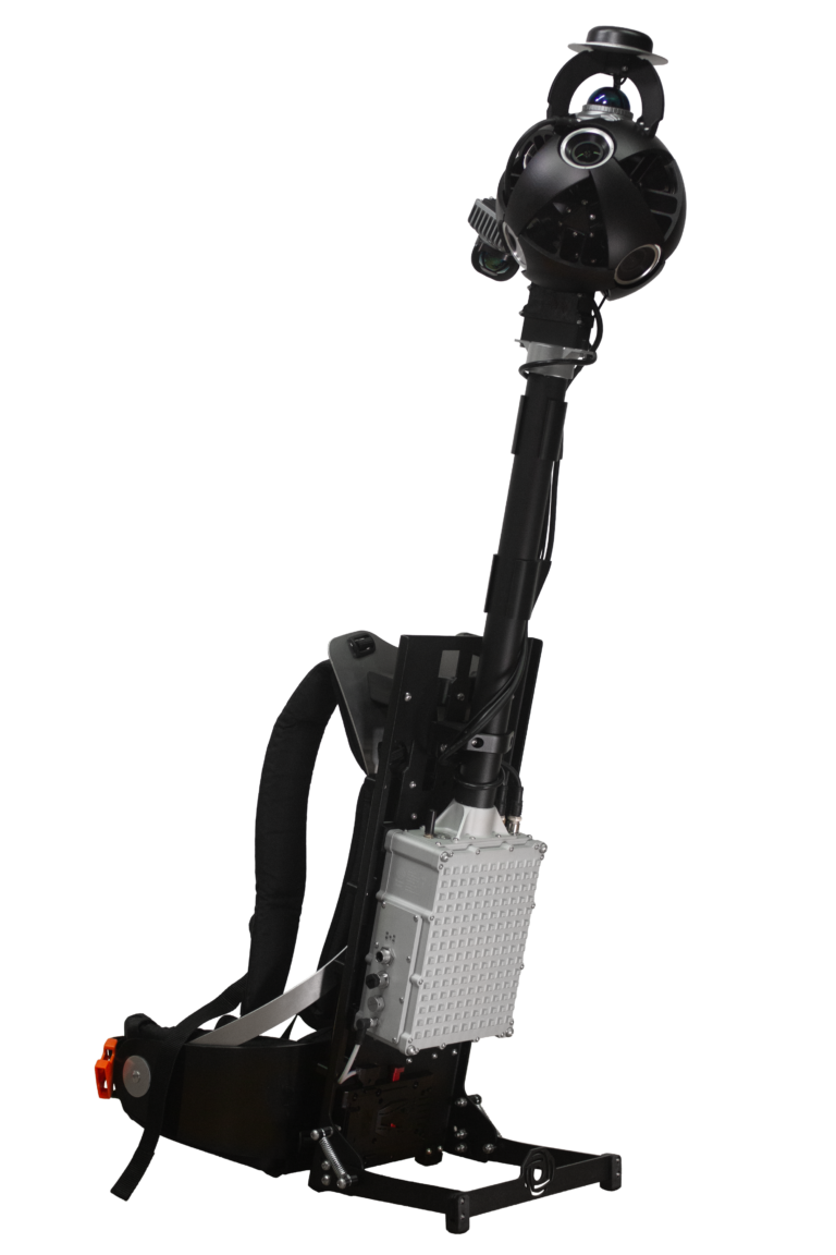
Fully spherical 360º mobile mapping backpack camera with LiDAR and GNSS
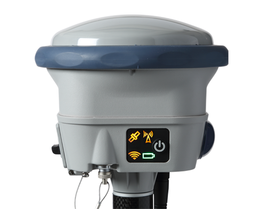
The Spectra Geospatial SP90m is a powerful, highly versatile, ultra-rugged, and reliable GNSS positioning solution for a wide variety of applications in real-time and post-processing.
Measure quicker and safer with IMU‑based tilt compensation.
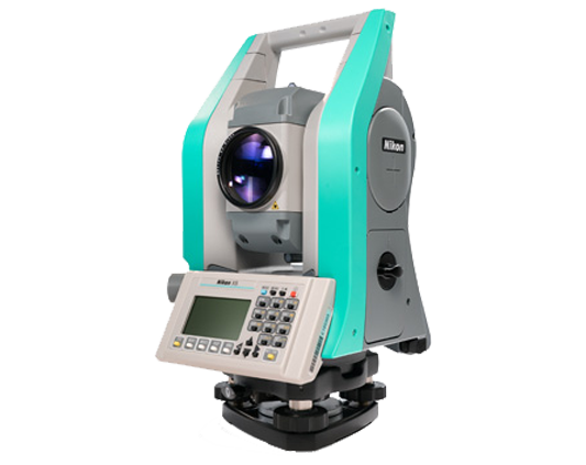
Nikon XS mechanical total station is built tough for all occasions.
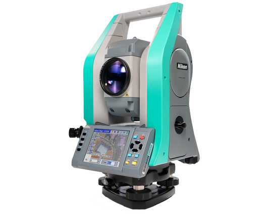
Nikon XF mechanical total station is built tough for all occasions.
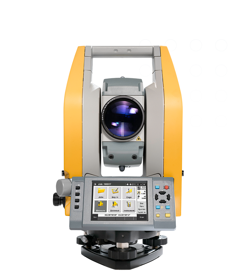
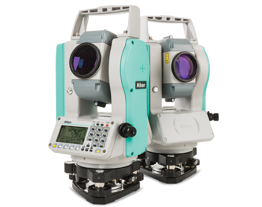
NIKON TOTAL STATIONS, BUILT TOUGH FOR ALL OCCASIONS.
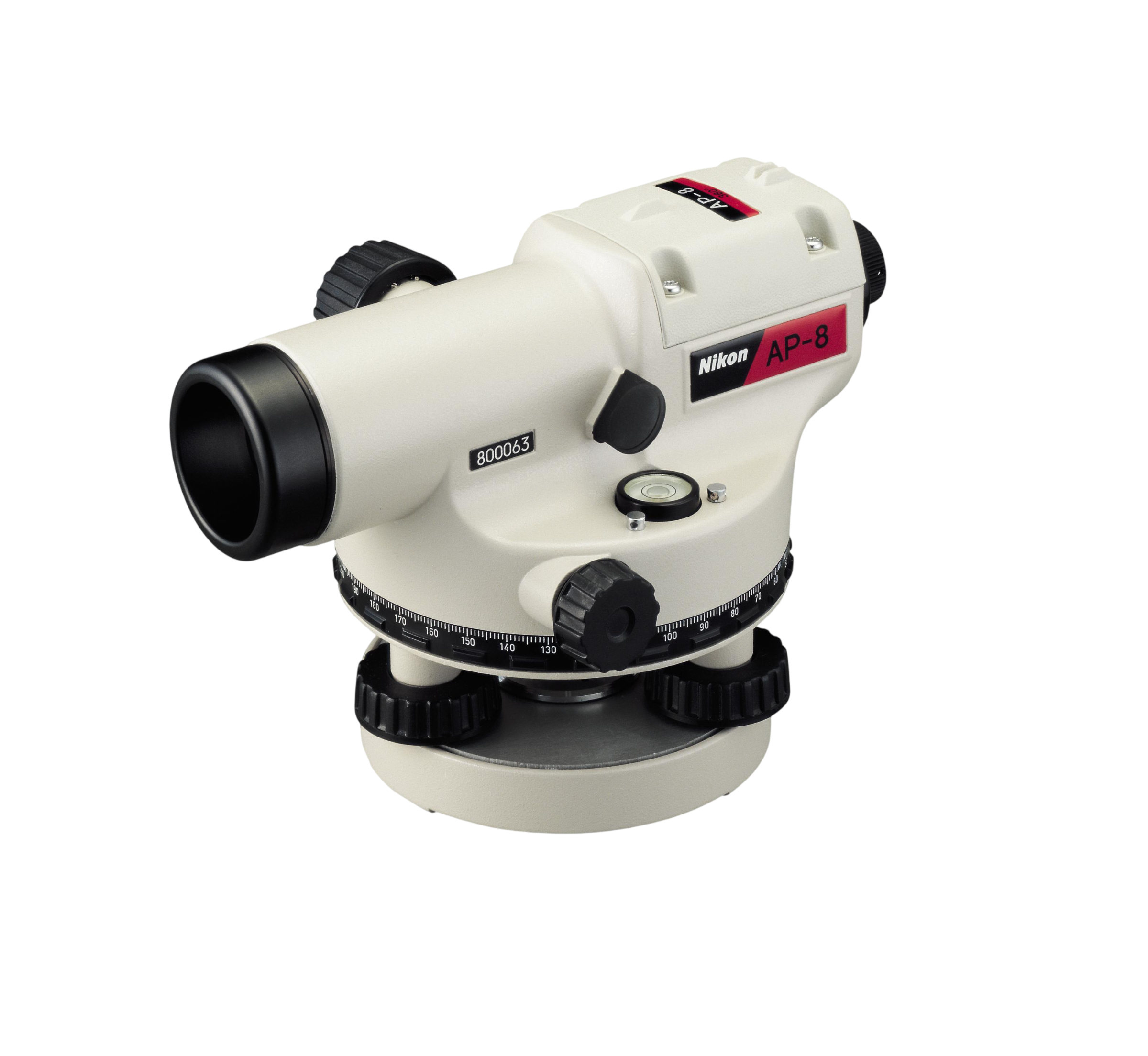
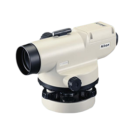
Nikon® automatic levels are designed for a variety of elevation control and alignment tasks including general building construction, cut and fill measurements, area leveling, and landscaping.