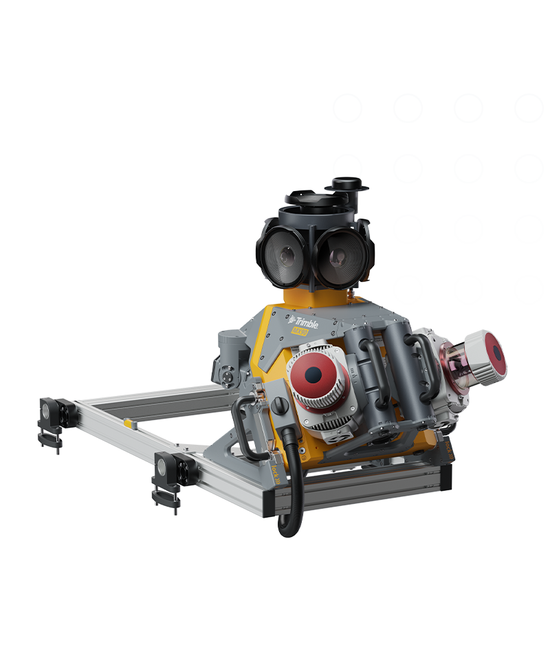
Trimble MX90

Achieve new levels of productivity.

The Trimble® MX90 system is part of a complete field-to-finish mobile mapping solution that combines leading-edge hardware with intuitive field software and an integrated office software workflow.

VIDEO

Trusted, field-proven mobile mapping

Capture immersive scans and images at highway speeds.

Benefits and performance

State-of-the-art GNSS and inertial technology, easy to install and simple to operate. With leading-edge image and LiDAR capabilities and intuitive field software.

Premium, powerful mobile mapping solution

Leverage your large-scale mobile mapping projects with the Trimble MX90, which delivers unmatched GNSS performance in challenging urban and rural environments from the Trimble ProPoint® engine.

Produce and share robust deliverables efficiently

Capture, process, extract and share high density point clouds and rich, immersive imagery to produce meaningful deliverables. Discover new productivity levels leveraging the complete Trimble field-to-finish workflow.